The airport diagram, from the runway to your stand
Zoom in on an airport on the SkyNexus map and the ground diagram is there: every runway with its markings, the taxiways with their names, the holding positions with their signs and stop bars, and each stand numbered where the aircraft stops. It covers more than 3,000 airports, it is free, and it sits on the same map as your route and your SID and STAR.
Stands where the aircraft stops
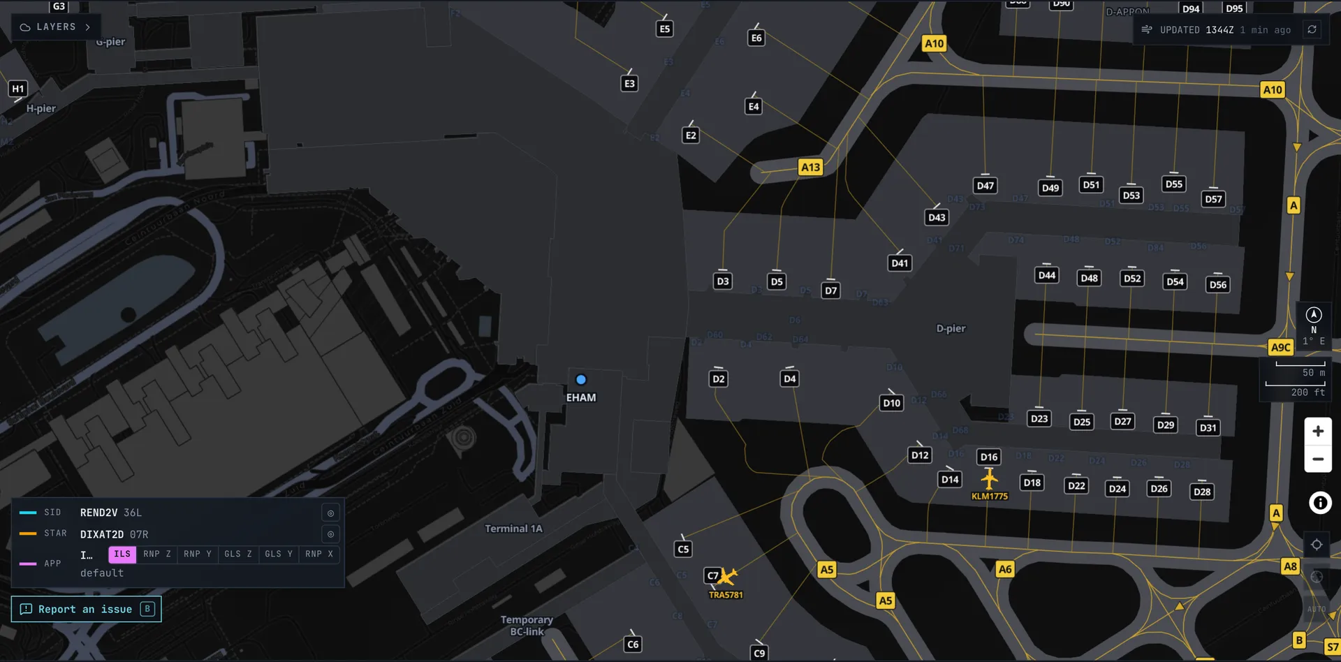
Each stand is a marker at the stop position with its painted number, and the lead-in line runs from the taxilane to that point, curving off where it meets the taxiway. So the gate ATC gives you is easy to find, and you can see the line you will follow to get there.
Holding positions, signs and stop bars
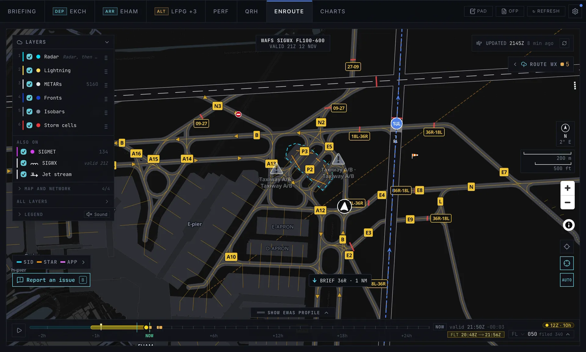
Holding positions follow the paint: one line across the taxiway, parallel to the runway where the paint is. The name of the holding point is on a location sign beside it, the way you see it from the cockpit, and the red stop bars are drawn across the taxiway where an airport has them. When ground clears you to hold short of a point, you can see where it is before you start to taxi.
One-way taxiways have arrowheads, a painted NO ENTRY shows as a sign, and tow routes are a dashed line.
Runways, lights and windsocks
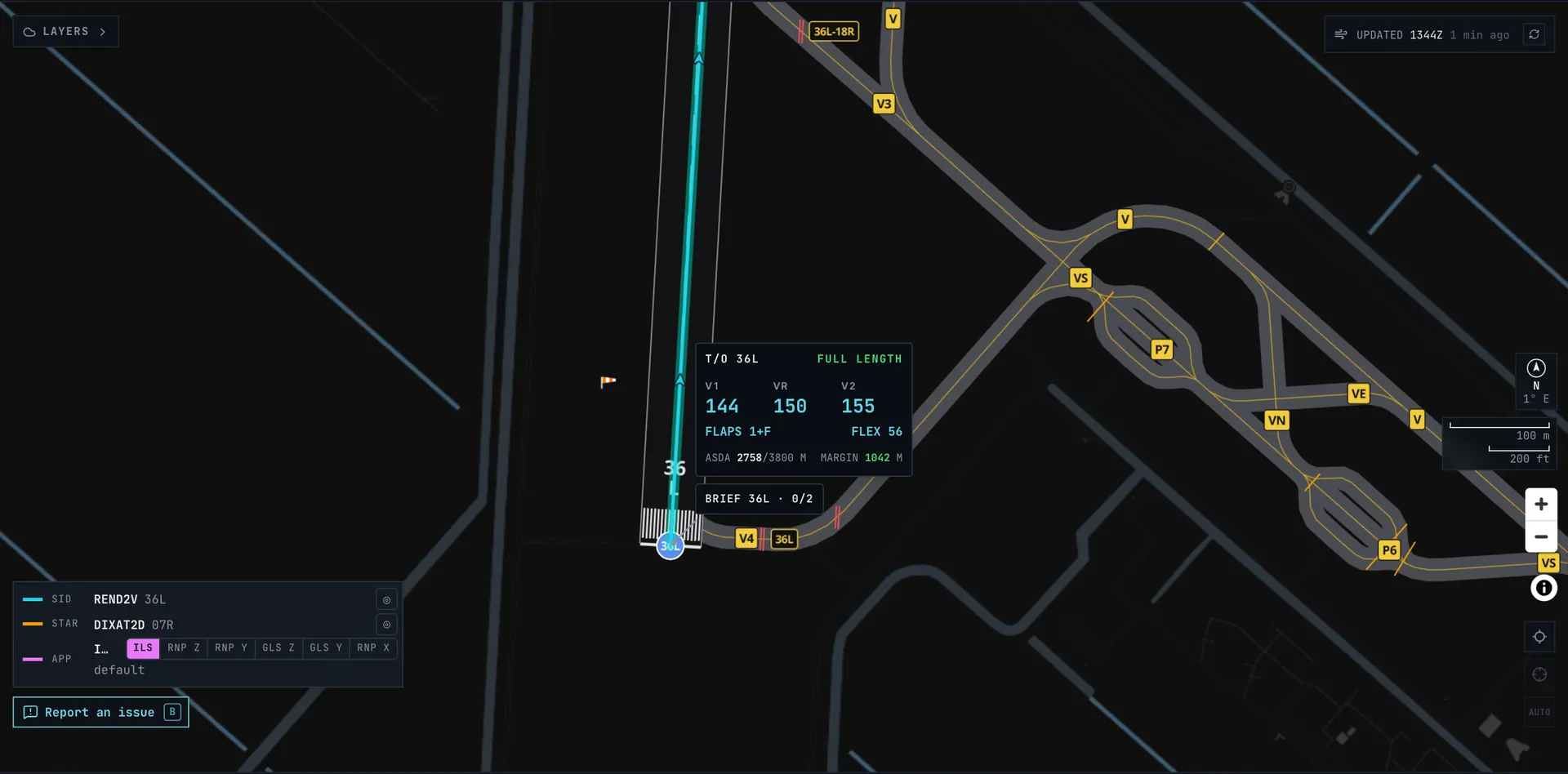
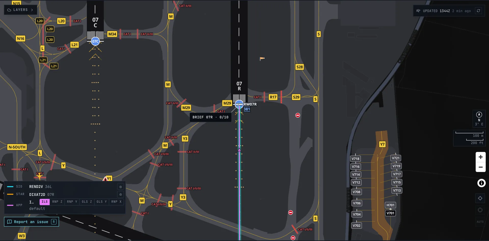
Runways carry threshold markings, the designator painted on the runway and arrows before a displaced threshold. Where the map data has them, the approach lights, the PAPIs beside the runway and the windsocks are drawn too. Amsterdam and Frankfurt have them mapped in full.
Zoom in and a scale bar in metres and feet appears, with the field's magnetic variation.
Checked by hand at the big airports
At some airports we went over the whole diagram by hand: every runway, taxiway, hold and stand compared with aerial photos, and what was off corrected. On the coverage map those airports have a gold ring. Amsterdam, Frankfurt, Munich, London Heathrow, Geneva and Innsbruck are the first, and more follow.
Where the diagrams come from
The diagrams are built from OpenStreetMap, the open map that volunteers keep up to date around the world. For German airports they come from the official DFS data. How much detail an airport has depends on how well it is mapped, so a big hub is usually complete and a small field may show only its runways and taxiways.
See a stand in the wrong place or a hold that is missing? Press Report an issue on the map (or B), drag a box over it and add a line. You get a reply by mail when it is fixed.
- OpenStreetMap copyright and licence for the map data.
More on the map
- SID and STAR charts with your departure, arrival and approach drawn on the same map.
- Navdata coverage to see which airports have procedures and a diagram.
- Airports with runways and example takeoff data.
Airport diagram FAQ
- Are the airport diagrams free?
- Yes. Create a free account and zoom in on any airport on the map. Nothing to install and no subscription.
- Which airports have a diagram?
- More than 3,000 airports worldwide: wherever OpenStreetMap has the airport mapped, and the German airports from DFS data. The coverage map shows which airports have one and which we checked by hand.
- Does it show my gate?
- If the airport's stands are mapped, yes: each stand has its number at the stop position. Find the stand ATC or your airline gives you on the map before you land, and follow its lead-in line once you are there.
- Is this the official airport chart?
- No. It is drawn from OpenStreetMap and, in Germany, DFS data, for flight simulation. For the official aerodrome chart, link your free ChartFox account and open it in the Charts tab.
- What does the gold ring mean?
- We checked that airport's diagram by hand against aerial photos: every runway, taxiway, holding position and stand, with what was off corrected.