Your SID, STAR and approach, drawn on the map
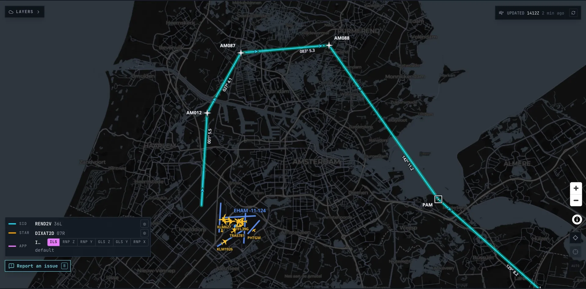
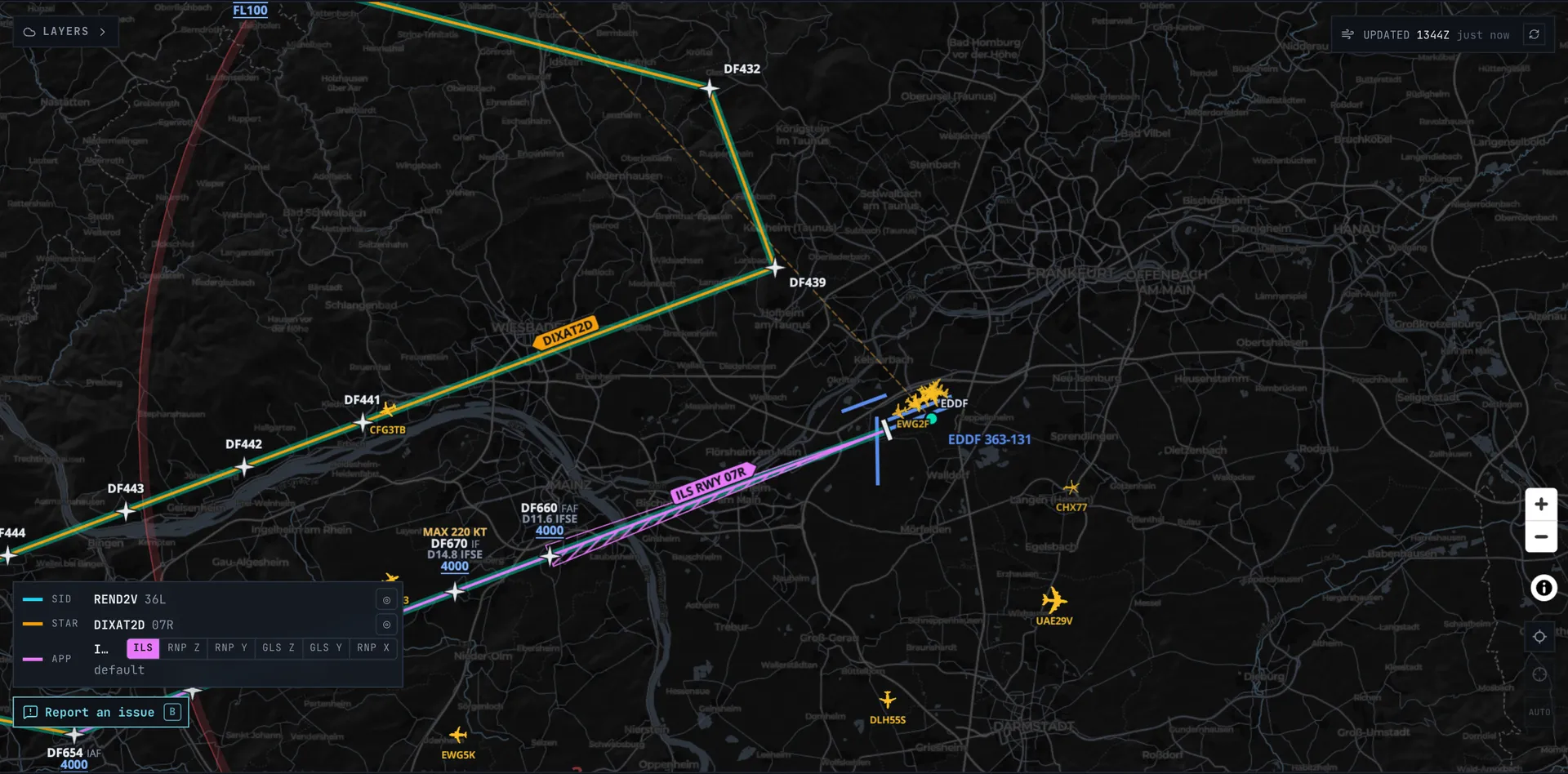
Load your SimBrief flight plan and SkyNexus draws the SID you filed, the STAR into your destination and the approach at the other end on the enroute map, with the altitude and speed limits at each fix. You can pick another one right on the map. It covers more than 3,400 airports in 18 countries, read from each country's official AIP and refreshed every AIRAC cycle. It is free and runs in your browser next to the sim.
Your procedures on the moving map
The departure starts at the runway end and follows the SID to where it joins your route. The arrival comes in along the STAR and the approach down to the runway. Every fix carries its limits the way a chart prints them: at or above, at or below, a window, and the speed limit where there is one. Each leg shows its course and distance, and the final approach its glide path.
Tap a procedure in the legend, or the line itself, and the map zooms to it and dims the rest. Your route and the weather layers stay on the same map.
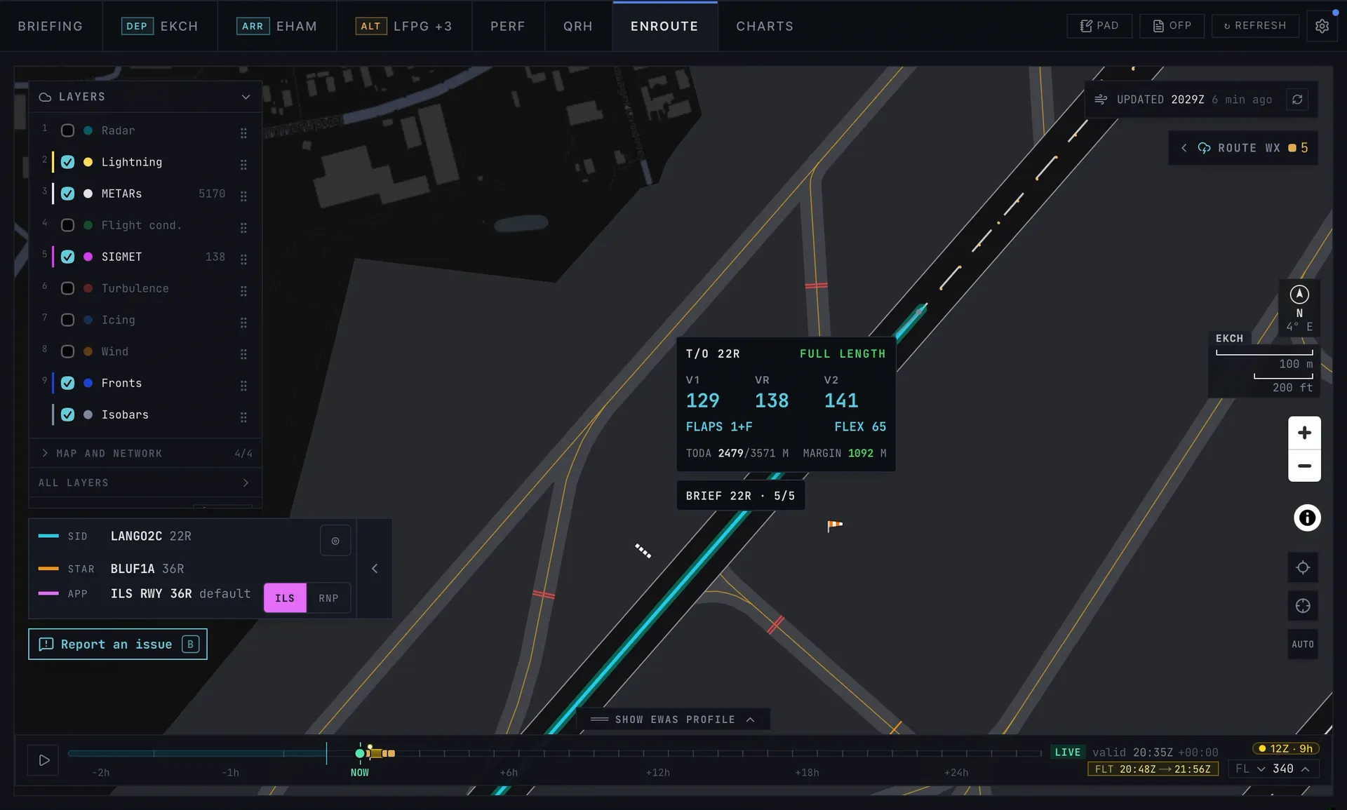
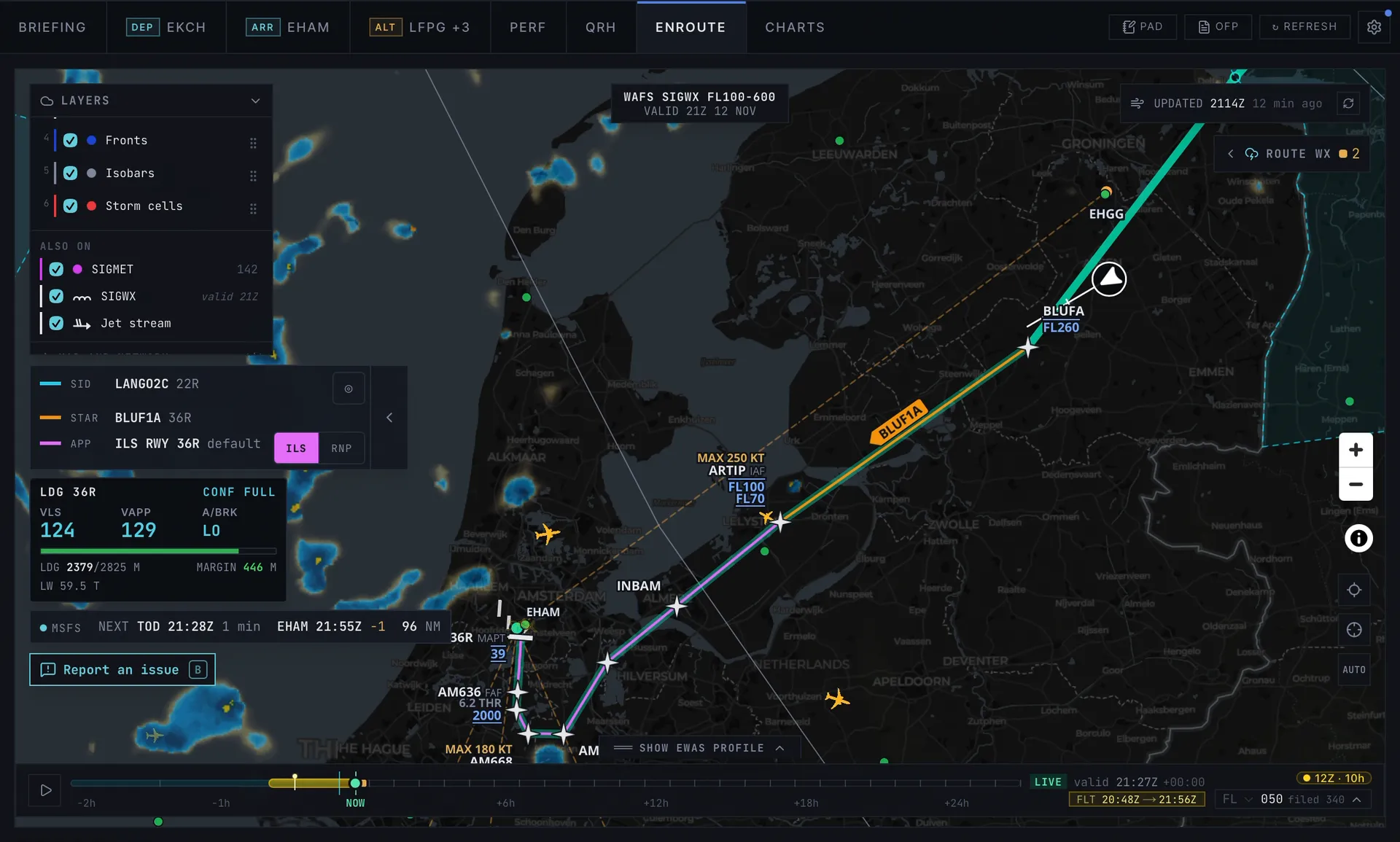
On a real flight, on an iPad
This is a live flight from Copenhagen to Amsterdam in an A320 in MSFS, with SkyNexus on an iPad next to the sim. The SkyNexus Connector sends the aircraft from the sim to the map, so the map follows the flight from the runway at Copenhagen to the stand at Schiphol.
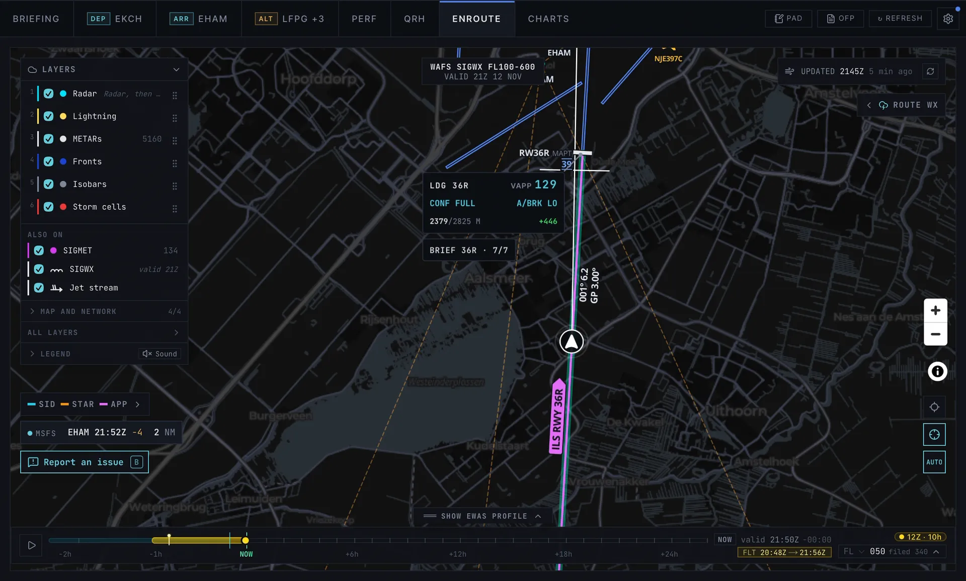
Pick another SID or STAR on the map
ATC gives you a different runway or a different arrival? Open the picker around the airport and every SID exit or STAR entry sits at its real bearing. Each one tells you whether it fits your route or how many miles it is from it. Pick one and the map redraws it, joined to your route. The choice is saved with that flight plan, and one tap takes you back to what you filed.
Approaches have their own buttons in the legend, ILS, RNP and the rest, so you can brief a different approach in a second.
A briefing card for each procedure
One tap opens the procedure sheet, with a tab for the departure, the arrival and the alternates. Each procedure has its own card with the airport elevation, the transition altitude and the MSA. For an alternate you can show its approach too, so the diversion is briefed before you need it.
Where the authority publishes a procedure we could not draw, the card says so under its heading. You never have to guess whether a missing approach is missing on purpose.
Read from the official AIP
Every procedure is read from the country that publishes it: the FAA's coded data in the United States and the official AIP everywhere else. We do not trace a route from a chart by eye, and anything we cannot read with confidence is left off rather than guessed. The procedure sheet names the source for each airport.
The data is refreshed every AIRAC cycle, every 28 days, so the procedures match the cycle you fly in.
- United States: the FAA, more than 3,000 airports.
- Europe: France, Germany, the UK, Spain, the Netherlands, Belgium and Luxembourg, Ireland, Portugal, Austria, Poland, Denmark, Norway, Sweden, Finland, Iceland and Latvia.
- Middle East: the United Arab Emirates.
Is your airport covered?
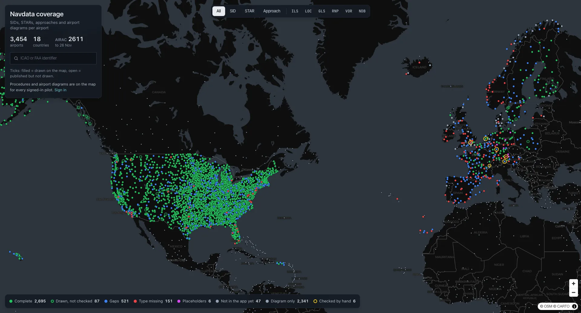
The coverage map shows every airport as one dot, coloured by how complete its SIDs, STARs and approaches are, and the airport card lists what is drawn and what is not. More countries follow as their data opens up.
- Open the coverage map and search for your departure and destination.
- How to read the coverage map with the colours and what each gap means.
Something does not match your chart?
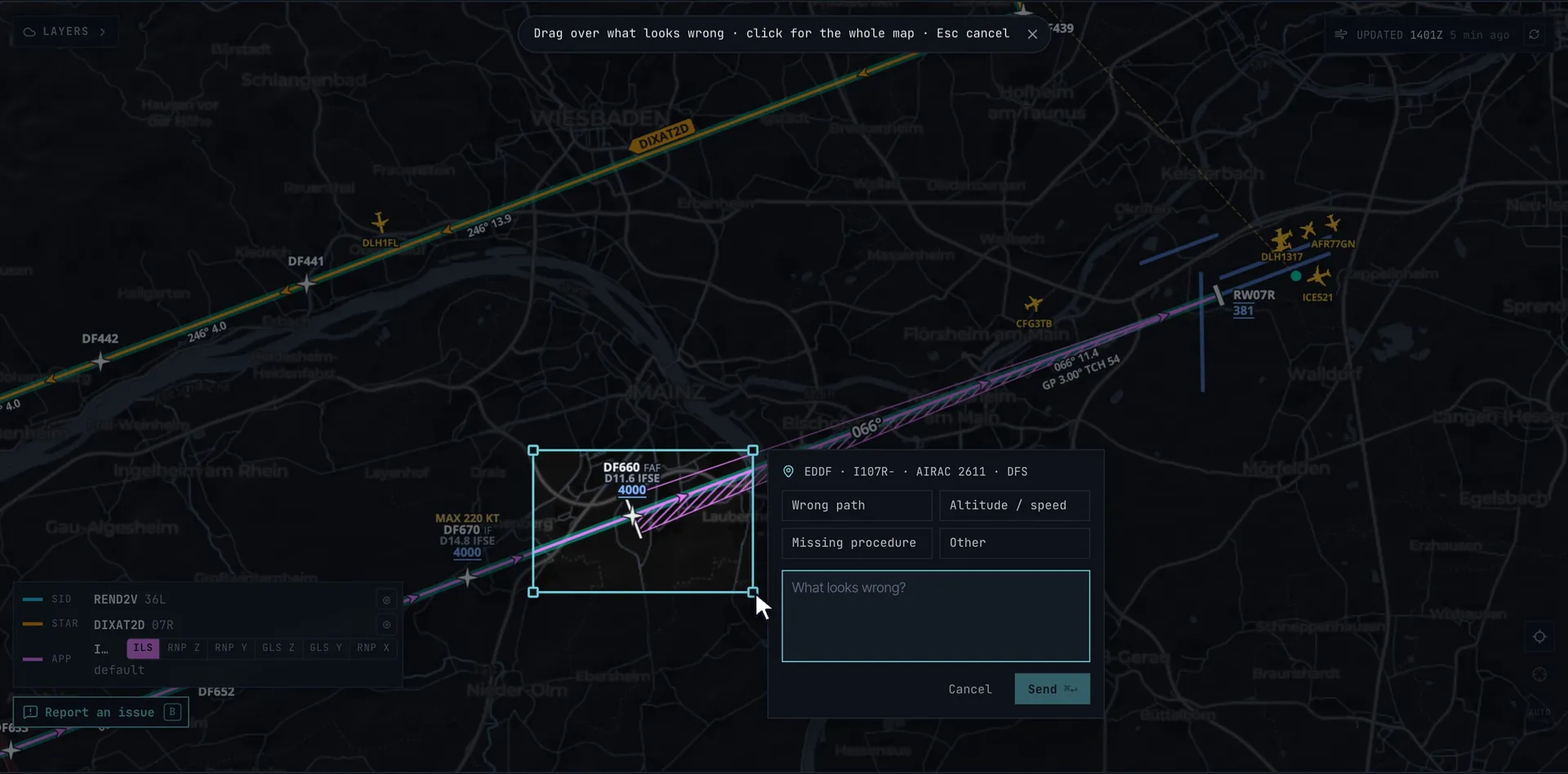
Press Report an issue on the map (or B), drag a box over the problem and add a line. We get a picture of exactly what you saw, and you get a reply by mail when it is fixed.
More on the map
- Airport diagrams with stands, holding positions, stop bars and approach lights.
- SimBrief EFB for the briefing that reads your OFP.
- Flight sim weather map with storms, turbulence and icing on the same route.
SID, STAR and approach FAQ
- Are the SIDs and STARs free?
- Yes. Create a free account, enter your SimBrief Pilot ID and the procedures for your flight are on the map. There is no subscription and nothing to install.
- Are these the chart plates?
- No. SkyNexus draws the procedure itself on the moving map, from the coded data, so it lines up with your route, the weather and the traffic. For the PDF plates, link your free ChartFox account and the Charts tab picks out the plates for your runway and procedures.
- Which airports have procedures?
- More than 3,400 airports in 18 countries: the whole FAA set in the United States, and the airports each European country and the UAE publish as coded data. The coverage map shows every airport and what is drawn there.
- How often is the data updated?
- Every AIRAC cycle, every 28 days. Each new cycle is read again from every source.
- Why is an approach missing at my airport?
- Most often the authority publishes that approach as a chart only, without the coded data we draw from. The procedure card and the coverage map say which approaches are published but not drawn, and why. If it looks like our mistake, press Report an issue and tell us.
- Does it work with MSFS, X-Plane and VATSIM?
- Yes. SkyNexus runs in a browser, so it works next to MSFS 2020, MSFS 2024, X-Plane and Prepar3D, and it reads your flight from SimBrief. On VATSIM it also shows controllers and traffic on the same map.
See your next SID and STAR on the map
Free, in your browser, from your SimBrief flight plan.
Open SkyNexus